Wells API error on RSEG data

Hi Combocurve,

I’m seeking to load RSEG header data into a project, in 1000 row chunks to observe the wells api limit, and i’m getting back a somewhat opaque failure:

What is producing this error? Column limit? Column naming? Other?
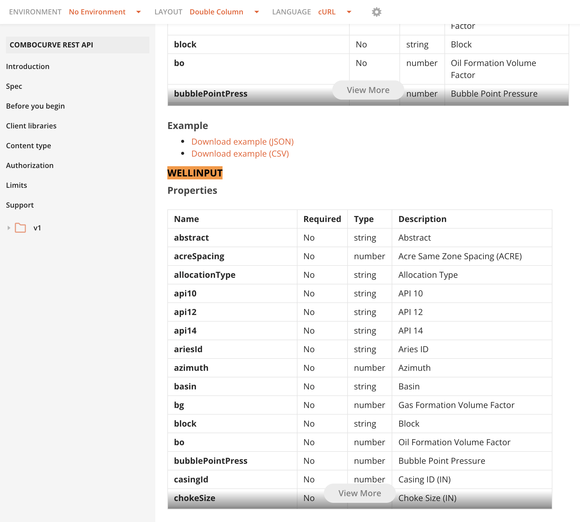
Is there a stock header mapping that you use for RSEG data?

Input:

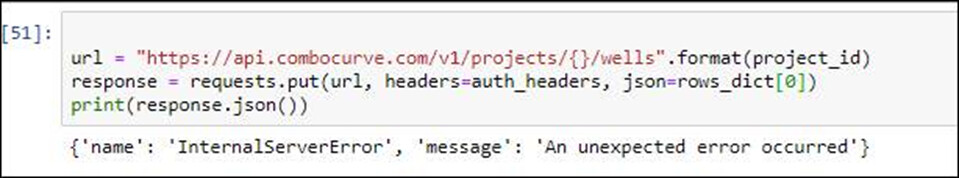
url = "https://api.combocurve.com/v1/projects/{}/wells".format(project_id)
response = requests.put(url, headers=auth_headers, json=rows_dict[0])
print(response.json())

Output:

{"name":"InternalServerError","message":"An unexpected error occurred"}

This put works on the dummy data in the docs, but fails for actual RSEG data.

Please see below for an example json row (rows_dict[0]).

{'API_UWI': '43-047-53693',

'Unformatted_API_UWI': 4304753693,

'API_UWI_12': '43-047-53693-00',

'Unformatted_API_UWI_12': 430475369300,

'API_UWI_14': '43-047-53693-00-00',

'Unformatted_API_UWI_14': 43047536930000,

'WellID': 840430000645240,

'CompletionID': nan,

'WellPadID': nan,

'WellPadDirection': nan,

'ENVWellGrouping': nan,

'CompletionNumber': nan,

'WellName': 'MU 921-30O3D-UBHZ',

'Country': 'US',

'StateProvince': 'UT',

'County': 'UINTAH',

'Lease': nan,

'LeaseName': nan,

'ENVOperator': 'OCCIDENTAL',

'RawOperator': 'KERR-MCGEE OIL & GAS ONSHORE, LP',

'InitialOperator': 'KERR-MCGEE OIL & GAS ONSHORE, LP',

'ENVTicker': 'OXY',

'ENV_Peer_Group': 'Large Cap',

'ENV_Stock_Exchange': 'NYSE',

'ENVWellServiceProvider': nan,

'ENVProdWellType': nan,

'StateWellType': 'OIL WELL',

'ENVWellType': 'OIL',

'ENVProducingMethod': nan,

'ENVRegion': 'ROCKIES',

'ENVBasin': 'UINTA',

'ENVPlay': 'UINTA',

'ENVSubPlay': 'UINTA MONUMENT BUTTE',

'ENVInterval': 'UINTA ALL',

'ENVIntervalSource': 'ENV INTERPRETED',

'ENVSpacingAssumption': nan,

'ENVWellStatus': 'PERMIT CANCELLED',

'OnConfidential': nan,

'OffConfidentialDate': nan,

'Trajectory': 'HORIZONTAL',

'ENVWellboreType': nan,

'Formation': 'GREEN RIVER',

'FirstProdDate': nan,

'Latitude': 40.012567,

'Longitude': -109.59157299999998,

'Latitude_BH': 39.999748,

'Longitude_BH': -109.593323,

'TVD_FT': nan,

'MD_FT': 9340.0,

'District': nan,

'Field': 'NATURAL BUTTES',

'Block': nan,

'Abstract': nan,

'Platform': nan,

'Section': '30',

'Township': '009S',

'Range': '021E',

'Section_Township_Range': '30-009S-021E',

'Unit_Name': nan,

'Vintage': nan,

'FirstProdQuarter': nan,

'FirstProdMonth': nan,

'ENVElevationKB_FT': 4866.552862395133,

'ENVElevationKBSource': 'CALC',

'ENVElevationGL_FT': 4846.867823025053,

'ENVElevationGLSource': 'ESTIMATED',

'ElevationKB_FT': nan,

'ElevationGL_FT': 4853.0,

'CoordinateSource': nan,

'PermitApprovedDate': '2013-03-20',

'PermitSubmittedDate': '2013-03-13',

'SpudDate': nan,

'DrillingEndDate': nan,

'RigReleaseDate': nan,

'CompletionDate': nan,

'FirstDay': nan,

'ENVCompInsertedDate': nan,

'StateFileNumber': nan,

'ENVFracJobType': nan,

'ENVFluidType': nan,

'CompletionTime_DAYS': nan,

'CompletionDesign': nan,

'PermitToSpud_DAYS': nan,

'SpudToRigRelease_DAYS': nan,

'SpudToCompletion_DAYS': nan,

'SpudToSales_DAYS': nan,

'SoakTime_DAYS': nan,

'NumberOfStrings': nan,

'UpperPerf_FT': nan,

'LowerPerf_FT': nan,

'PerfInterval_FT': nan,

'LateralLength_FT': 4452.0396,

'FracStages': nan,

'AverageStageSpacing_FT': nan,

'ENVProppantBrand': nan,

'ProppantLoading_LBSPerGAL': nan,

'ENVProppantType': nan,

'ProppantIntensity_LBSPerFT': nan,

'Proppant_LBS': nan,

'TotalWaterPumped_GAL': nan,

'WaterIntensity_GALPerFT': nan,

'TotalFluidPumped_BBL': nan,

'FluidIntensity_BBLPerFT': nan,

'AcidVolume_BBL': nan,

'Bottom_Hole_Temp_DEGF': nan,

'Biocide_LBS': nan,

'Breaker_LBS': nan,

'Buffer_LBS': nan,

'ClayControl_LBS': nan,

'CrossLinker_LBS': nan,

'FrictionReducer_LBS': nan,

'GellingAgent_LBS': nan,

'IronControl_LBS': nan,

'ScaleInhibitor_LBS': nan,

'Surfactant_LBS': nan,

'Energizer_LBS': nan,

'Diverter_LBS': nan,

'TestDate': nan,

'ChokeSize_64IN': nan,

'TestRate_BOEPerDAY': nan,

'TestRate_BOEPerDAYPer1000FT': nan,

'TestRate_MCFEPerDAY': nan,

'OilTestRate_BBLPerDAY': nan,

'OilTestRate_BBLPerDAYPer1000FT': nan,

'GasTestRate_MCFPerDAY': nan,

'GasTestRate_MCFPerDAYPer1000FT': nan,

'WaterTestRate_BBLPerDAY': nan,

'WaterTestRate_BBLPerDAYPer1000Ft': nan,

'WaterDepth': nan,

'TestWHLiquids_PCT': nan,

'CasingPressure_PSI': nan,

'FlowingTubingPressure_PSI': nan,

'ShutInPressure_PSI': nan,

'OilProdPriorTest_BBL': nan,

'OilTestMethodName': nan,

'OilGravity_API': nan,

'GasGravity_SG': nan,

'First3MonthProd_BOE': nan,

'First3MonthProd_BOEPer1000FT': nan,

'First3MonthGas_MCF': nan,

'First3MonthGas_MCFPer1000FT': nan,

'First3MonthProd_MCFE': nan,

'First3MonthProd_MCFEPer1000FT': nan,

'First3MonthOil_BBL': nan,

'First3MonthOil_BBLPer1000FT': nan,

'First3MonthWater_BBL': nan,

'First6MonthProd_BOE': nan,

'First6MonthProd_BOEPer1000FT': nan,

'First6MonthGas_MCF': nan,

'First6MonthGas_MCFPer1000FT': nan,

'First6MonthProd_MCFE': nan,

'First6MonthProd_MCFEPer1000FT': nan,

'First6MonthOil_BBL': nan,

'First6MonthOil_BBLPer1000FT': nan,

'First6MonthWater_BBL': nan,

'First9MonthProd_BOE': nan,

'First9MonthProd_BOEPer1000FT': nan,

'First9MonthGas_MCF': nan,

'First9MonthGas_MCFPer1000FT': nan,

'First9MonthProd_MCFE': nan,

'First9MonthProd_MCFEPer1000FT': nan,

'First9MonthOil_BBL': nan,

'First9MonthOil_BBLPer1000FT': nan,

'First9MonthWater_BBL': nan,

'First12MonthProd_BOE': nan,

'First12MonthProd_BOEPer1000FT': nan,

'First12MonthGas_MCF': nan,

'First12MonthGas_MCFPer1000FT': nan,

'First12MonthProd_MCFE': nan,

'First12MonthProd_MCFEPer1000FT': nan,

'First12MonthOil_BBL': nan,

'First12MonthOil_BBLPer1000FT': nan,

'First12MonthWater_BBL': nan,

'First36MonthProd_BOE': nan,

'First36MonthProd_BOEPer1000FT': nan,

'First36MonthGas_MCF': nan,

'First36MonthGas_MCFPer1000FT': nan,

'First36MonthProd_MCFE': nan,

'First36MonthProd_MCFEPer1000FT': nan,

'First36MonthOil_BBL': nan,

'First36MonthOil_BBLPer1000FT': nan,

'First36MonthWater_BBL': nan,

'First36MonthWaterProductionBBLPer1000Ft': nan,

'PeakProductionDate': nan,

'MonthsToPeakProduction': nan,

'PeakProd_BOE': nan,

'PeakProd_BOEPer1000FT': nan,

'PeakGas_MCF': nan,

'PeakGas_MCFPer1000FT': nan,

'PeakProd_MCFE': nan,

'PeakProd_MCFEPer1000FT': nan,

'PeakOil_BBL': nan,

'PeakOil_BBLPer1000FT': nan,

'PeakWater_BBL': nan,

'CumProd_BOE': nan,

'CumProd_BOEPer1000FT': nan,

'CumGas_MCF': nan,

'CumGas_MCFPer1000FT': nan,

'CumProd_MCFE': nan,

'CumProd_MCFEPer1000FT': nan,

'CumOil_BBL': nan,

'CumOil_BBLPer1000FT': nan,

'CumWater_BBL': nan,

'TotalProducingMonths': nan,

'LastProducingMonth': nan,

'LastMonthLiquidsProduction_BBL': nan,

'LastMonthGasProduction_MCF': nan,

'LastMonthWaterProduction_BBL': nan,

'Last12MonthBOEProduction': nan,

'Last12MonthGasProduction_MCF': nan,

'Last12MonthOilProduction_BBL': nan,

'Last12MonthWaterProduction_BBL': nan,

'WHLiquids_PCT': nan,

'GOR_ScfPerBbl': nan,

'CumulativeSOR': nan,

'Last3MonthISOR': nan,

'Tortuosity': nan,

'ToeAngle_DEG': nan,

'AzimuthFromGridNorth_DEG': nan,

'ParentChildAnyZone': nan,

'ParentChildSameZone': nan,

'BoundedAnyZone': nan,

'BoundedSameZone': nan,

'Bounded100dVZoneCurrent': nan,

'BoundedAnyZoneInitial': nan,

'BoundedSameZoneInitial': nan,

'Bounded100dVZoneInitial': nan,

'CoCompletion': nan,

'WellDensityAnyZone': nan,

'WellDensitySameZone': nan,

'WellsPerSectionAnyZone': nan,

'WellsPerSectionSameZone': nan,

'ENVOilGatherer': nan,

'ENVGasGatherer': 'MPLX',

'ENVOilGatheringSystem': nan,

'ENVGasGatheringSystem': 'UINTA BASIN',

'ImpliedWellSpacingSameZone_FT': nan,

'AvgHzDistAtDrillTimeSameZone_FT': nan,

'AvgVtDistAtDrillTimeSameZone_FT': nan,

'ClosestHzDistAtDrillTimeSameZone_FT': nan,

'ClosestVtDistAtDrillTimeSameZone_FT': nan,

'AvgHzDistAtDrillTimeAnyZone_FT': nan,

'AvgVtDistAtDrillTimeAnyZone_FT': nan,

'ClosestHzDistAtDrillTimeAnyZone_FT': nan,

'ClosestVtDistAtDrillTimeAnyZone_FT': nan,

'ClosestHzDistAtDrillTime100dVZone_FT': nan,

'ClosestVtDistAtDrillTime100dVZone_FT': nan,

'AvgHzDistAtDrillTime100dVZone_FT': nan,

'AvgVtDistAtDrillTime100dVZone_FT': nan,

'AvgHzDistSameZone_FT': nan,

'AvgVtDistSameZone_FT': nan,

'ClosestHzDistSameZone_FT': nan,

'ClosestVtDistSameZone_FT': nan,

'AvgHzDistAnyZone_FT': nan,

'AvgVtDistAnyZone_FT': nan,

'ClosestHzDistAnyZone_FT': nan,

'ClosestVtDistAnyZone_FT': nan,

'ClosestHzDist100dVZone_FT': nan,

'ClosestVtDist100dVZone_FT': nan,

'AvgHzDist100dVZone_FT': nan,

'AvgVtDist100dVZone_FT': nan,

'RoyaltyRateOil_PCT': 0.2,

'RoyaltyRateGas_PCT': 0.2,

'RoyaltyRateNGL_PCT': 0.2,

'OilDifferential_PCT': 1.0,

'OilDifferential_USDPerBBL': -4.5,

'NGLDifferential_PCT': 0.3,

'NGLDifferential_USDPerBBL': 0.0,

'GasDifferential_PCT': 1.0,

'GasDifferential_USDPerMCF': -0.55,

'PostProcessingGrossUp_PCT': nan,

'TotalOpex_USDPerBOE': nan,

'VariableOpex_USDPerBOE': nan,

'TransportationCost_USDPerBOE': nan,

'FixedOpex_USDPerWELLPerMONTH': 0.0,

'ProcessingFee_USDPerMCF': nan,

'GAndA_USDPerBOE': 0.0,

'OilSeveranceTax_PCT': 0.046,

'NGLSeveranceTax_PCT': 0.075,

'GasSeveranceTax_PCT': 0.075,

'DrillingCost_USDMM': nan,

'CompletionCost_USDMM': nan,

'TieInCost_USDMM': nan,

'TotalWellCost_USDMM': nan,

'DrillingCostHistorical_USDMM': nan,

'CompletionCostHistorical_USDMM': nan,

'TieInCostHistorical_USDMM': nan,

'TotalWellCostHistorical_USDMM': nan,

'GasShrink_PCT': nan,

'NGLYield_BBLPerMMCF': nan,

'GenericDrainage_AC': nan,

'NPVPerWELLAt50And200_USDMM': nan,

'NPVPerWELLAt55And300_USDMM': nan,

'NPVPerWELLAt60And300_USDMM': nan,

'NPVPerWELLAt60And350_USDMM': nan,

'NPVPerWELLAt50And200Historical_USDMM': nan,

'NPVPerWELLAt55And300Historical_USDMM': nan,

'NPVPerWELLAt60And300Historical_USDMM': nan,

'NPVPerWELLAt60And350Historical_USDMM': nan,

'NPVPerSectionAnyZone_USDMM': nan,

'NPVPerSectionSameZone_USDMM': nan,

'HistoricalNPVPerSectionAnyZone': nan,

'HistoricalNPVPerSectionSameZone': nan,

'GenericAcreValue10Yr_USD': nan,

'IRRPerWELLAt50And200_USDMM': nan,

'IRRPerWELLAt55And300_USDMM': nan,

'IRRPerWELLAt60And300_USDMM': nan,

'IRRPerWELLAt60And350_USDMM': nan,

'IRRPerWELLAt50And200Historical_USDMM': nan,

'IRRPerWELLAt55And300Historical_USDMM': nan,

'IRRPerWELLAt60And300Historical_USDMM': nan,

'IRRPerWELLAt60And350Historical_USDMM': nan,

'PayoutPeriod_MONTHS': nan,

'FindingAndDevelopment_USDPerBOE': nan,

'NetbackPerWELLAt50And200_USDMM': nan,

'NetbackPerWELLAt55And300_USDMM': nan,

'NetbackPerWELLAt60And300_USDMM': nan,

'NetbackPerWELLAt60And350_USDMM': nan,

'RecycleRatioPerWELLAt50And200_USDMM': nan,

'RecycleRatioPerWELLAt55And300_USDMM': nan,

'RecycleRatioPerWELLAt60And300_USDMM': nan,

'RecycleRatioPerWELLAt60And350_USDMM': nan,

'CapitalEfficiency_USDPerBOEPerDAY': nan,

'EURWH_MBOE': nan,

'OilEURWH_MBBL': nan,

'GasEURWH_BCF': nan,

'EURWH_MBOE_360': nan,

'EURWH_BCFE_360': nan,

'EURWH_MBBL_360': nan,

'EURWH_BCF_360': nan,

'EURWH_MBOE_180': nan,

'EURWH_MBOE_120': nan,

'EURWH_MBOE_60': nan,

'ForecastWHLiquids_PCT': nan,

'EURPP_MBOE': nan,

'EURPerSectionAnyZone_MBOE': nan,

'EURPerSectionSameZone_MBOE': nan,

'EURPerSectionAnyZone_MBBL': nan,

'EURPerSectionSameZone_MBBL': nan,

'OilEURPP_PCT': nan,

'NGLEURPP_PCT': nan,

'GasEURPP_PCT': nan,

'BE15To1WTINYMEX_USDPerBBL': nan,

'BE20To1WTINYMEX_USDPerBBL': nan,

'BE25To1WTINYMEX_USDPerBBL': nan,

'BE15To1WTINYMEXHistorical_USDPerBBL': nan,

'BE20To1WTINYMEXHistorical_USDPerBBL': nan,

'BE25To1WTINYMEXHistorical_USDPerBBL': nan,

'BE15To1WTIYMEX_USDPerMcf': nan,

'BE20To1WTINYMEX_USDPerMcf': nan,

'BE25To1WTINYMEX_USDPerMcf': nan,

'BE15To1WTINYMEXHistorical_USDPerMcf': nan,

'BE20To1WTINYMEXHistorical_USDPerMcf': nan,

'BE25To1HHNYMEXHistorical_USDPerMcf': nan,

'TopOfZone_FT': nan,

'BottomOfZone_FT': nan,

'SubseaTopDepth_FT': nan,

'SubseaBaseDepth_FT': nan,

'Isopach_FT': nan,

'GammaRay_API': nan,

'BulkDensity_GPerCC': nan,

'Resistivity_OHMSM': nan,

'DensityPorosity_PCT': nan,

'EffectivePorosity_PCT': nan,

'ClayVolume_PCT': nan,

'NonClayVolume_PCT': nan,

'WaterSaturation_PCT': nan,

'PhiH_FT': nan,

'HCPV_PCT': nan,

'HeightOfHCPV_FT': nan,

'TotalOrganicCarbon_WTPCT': nan,

'GasInitialRate': nan,

'GasBFactor': nan,

'GasInitialDecline': nan,

'GasTerminalDecline': nan,

'GasDailyPeakEURRatio_MCFtoMCFPerDay': nan,

'GasGroupLevel': nan,

'GasGroupID': nan,

'GasFirstTC_MONTH': nan,

'GasRefCompletionUsage': nan,

'OilInitialRate': nan,

'OilBFactor': nan,

'OilInitialDecline': nan,

'OilTerminalDecline': nan,

'OilDailyPeakEURRatio_BBLPerDaytoMBBL': nan,

'OilGroupLevel': nan,

'OilGroupID': nan,

'OilFirstTC_MONTH': nan,

'OilRefCompletionUsage': nan,

'ClosestAnyProdMonthDiff': 0.0,

'AverageAnyProdMonthDiff': 0.0,

'ClosestSameProdMonthDiff': 0.0,

'AverageSameProdMonthDiff': 0.0,

'Closest100dVProdMonthDiff': 0.0,

'Average100dVProdMonthDiff': 0.0,

'ClosestAnyPercentEurPreWBT': 0.0,

'AverageAnyPercentEurPreWBT': 0.0,

'ClosestSamePercentEurPreWBT': 0.0,

'AverageSamePercentEurPreWBT': 0.0,

'Closest100dVPercentEurPreWBT': 0.0,

'Average100dVPercentEurPreWBT': 0.0,

'EURAnyCloPercentWBTNNS': nan,

'EURAnyAvgPercentWBTNNS': nan,

'EURSameCloPercentWBTNNS': nan,

'EURSameAvgPercentWBTNNS': nan,

'EUR100dVCloPercentWBTNNS': nan,

'EUR100dVAvgPercentWBTNNS': nan,

'ENVSpacingClass_AnyZone': nan,

'ENVSpacingClass_SameZone': nan,

'ENVSpacingClass_Within100': nan,

'ENVSpacingClass_AnyZoneAtInitialClass': nan,

'ENVSpacingClass_SameZoneAtInitialClass': nan,

'ENVSpacingClass_Vertical100AtInitialClass': nan,

'ParentChildVertical100': nan,

'ParentChildAnyZoneAtInitial': nan,

'ParentChildSameZoneAtInitial': nan,

'ParentChildVertical100AtInitial': nan,

'SpudDateSource': nan,

'TestRate_MCFEPerDAYPer1000FT': nan,

'FirstProdYear': nan,

'Avg3DDistSameZone_FT': nan,

'VerticalBoundedSameZoneAtInitial': nan,

'VerticalBoundedSameZoneAtCurrent': nan,

'NearNeighborCountSameZone': nan,

'Closest3DDistAtDrillTimeAnyZone_FT': nan,

'Closest3DDistAtDrillTimeSameZone_FT': nan,

'Avg3DDistAtDrillTimeAnyZone_FT': nan,

'Avg3DDistAtDrillTimeSameZone_FT': nan,

'Closest3DDistToParentAtDrillTimeAnyZone_FT': nan,

'Closest3DDistToParentAtDrillTimeSameZone_FT': nan,

'Avg3DDistToParentAtDrillTimeAnyZone_FT': nan,

'Avg3DDistToParentAtDrillTimeSameZone_FT': nan,

'ClosestHzDistToParentAtDrillTimeAnyZone_FT': nan,

'ClosestHzDistToParentAtDrillTimeSameZone_FT': nan,

'AvgHzDistToParentAtDrillTimeAnyZone_FT': nan,

'AvgHzDistToParentAtDrillTimeSameZone_FT': nan,

'ClosestVtDistToParentAtDrillTimeAnyZone_FT': nan,

'ClosestVtDistToParentAtDrillTimeSameZone_FT': nan,

'AvgVtDistToParentAtDrillTimeAnyZone_FT': nan,

'AvgVtDistToParentAtDrillTimeSameZone_FT': nan,

'ParentWellCountAtDrillTimeAnyZone': nan,

'ParentWellCountAtDrillTimeSameZone': nan,

'VerticalBoundedAtDrillTimeAnyZone': nan,

'NearNeighborCountAtDrillTimeAnyZone': nan,

'NearNeighborCountAtDrillTimeSameZone': nan,

'Closest3DDistAnyZone_FT': nan,

'Closest3DDistSameZone_FT': nan,

'Avg3DDistAnyZone_FT': nan,

'VerticalBoundedAnyZone': nan,

'NearNeighborCountAnyZone': nan,

'Closest3DDistAtDrillTime100dVZone_FT': nan,

'Avg3DDistAtDrillTime100dVZone_FT': nan,

'Closest3DDistToParentAtDrillTime100dVZone_FT': nan,

'Avg3DDistToParentAtDrillTime100dVZone_FT': nan,

'ClosestHzDistToParentAtDrillTime100dVZone_FT': nan,

'AvgHzDistToParentAtDrillTime100dVZone_FT': nan,

'ParentWellCountAtDrillTime100dVZone': nan,

'NearNeighborCountAtDrillTime100dVZone': nan,

'Closest3DDist100dVZone_FT': nan,

'Avg3DDist100dVZone_FT': nan,

'NearNeighborCount100dVZone': nan,

'ClosestVtDistToParentAtDrillTime100dVZone_FT': nan,

'AvgVtDistToParentAtDrillTime100dVZone_FT': nan,

'VerticalBoundedAtDrillTime100dVZone': nan,

'VerticalBounded100dVZone': nan,

'VerticalParentChildAtDrillTimeSameZone': nan,

'EnvVerticalSpacingClassAtDrillTimeSameZone': nan,

'VerticalParentChildSameZone': nan,

'EnvVerticalSpacingClassSameZone': nan,

'VerticalParentChildAtDrillTimeAnyZone': nan,

'EnvVerticalSpacingClassAtDrillTimeAnyZone': nan,

'VerticalParentChildAnyZone': nan,

'EnvVerticalSpacingClassAnyZone': nan,

'VerticalParentChildAtDrillTime100dVZone': nan,

'EnvVerticalSpacingClassAtDrillTime100dVZone': nan,

'VerticalParentChild100dVZone': nan,

'EnvVerticalSpacingClass100dVZone': nan,

'EURWH_MBOEPer1000FT': nan,

'EURWH_MBOE_60Per1000FT': nan,

'EURWH_MBOE_120Per1000FT': nan,

'EURWH_MBOE_180Per1000FT': nan,

'EURWH_MBOE_360PEr1000FT': nan,

'EURWH_BCFE_360Per1000FT': nan,

'OilEURWH_MBBLPer1000FT': nan,

'EURWH_MBBL_360Per1000FT': nan,

'GasEURWH_BCFPer1000FT': nan,

'EURWH_BCF_360Per1000FT': nan,

'EURPP_MBOEPer1000FT': nan,

'CountPadWells': 5.0,

'PadConstructDateDetected': nan,

'SpudDateDetected': nan,

'PadID': '43-047-53692',

'Last3DayTelemetryActivity': 0,

'LastWeekTelemetryActivity': 0,

'LastMonthTelemetryActivity': 0,

'LastYearTelemetryActivity': 1,

'DetectedFracCrewDate': nan,

'DaysOnSite': nan}

@nick.franciose at first glance - your trying to PUT wells to a project scope when the API can only PUT/POST from company level scope see here from the forms: Concept: Scope, company vs. project for wells

@nick.franciose don’t quote me on this but I would try using your dev environment company scoped wells to house all the RSEG data and your production for just your firms wells

Hi Michael,

Thanks for your response. I had no problem putting dummy data to that project using the project/wells endpoint, even when the wells did not exist at the company level – I don’t think that’s the issue.

https://api.combocurve.com/v1/projects/:projectId/wells

But thank you for taking the time to respond.

Nick

no worries - another thing, did you assign chosenId to the RSEG data? I might have missed it scrolling through the JSON you posted, but that could be giving the error @nick.franciose

I did, per Maikel’s post:

image

Ahhhhhhhhhhh yes its DI data - maybe switch to a POST request? Outside of that, I am out of ideas :sweat_smile:

Same result for post. Thx.

Hello @nick.franciose, thanks for create a post in our forum. The error you are having is because the json body in the request is not correct. You are getting a BadRequest status code, but for some reason the response message is not correct. Unexpected token N in JSON at position 257 is the response you should get. We are going to investigate why the response is not correctly populated to you.

You can get the json body request with response.request.body and check why it is not correct

Hope this help.

Regards

Hi Jorge,

The json body is shown below. Can you please identify what specifically is incorrect? Note: “api14” and “dataSource” keys added at end. The request fails with and without “chosenID” key included.

b'{"API_UWI": "43-047-53693", "Unformatted_API_UWI": 4304753693, "API_UWI_12": "43-047-53693-00", "Unformatted_API_UWI_12": 430475369300, "API_UWI_14": "43-047-53693-00-00", "Unformatted_API_UWI_14": 43047536930000, "WellID": 840430000645240, "CompletionID": NaN, "WellPadID": NaN, "WellPadDirection": NaN, "ENVWellGrouping": NaN, "CompletionNumber": NaN, "WellName": "MU 921-30O3D-UBHZ", "Country": "US", "StateProvince": "UT", "County": "UINTAH", "Lease": NaN, "LeaseName": NaN, "ENVOperator": "OCCIDENTAL", "RawOperator": "KERR-MCGEE OIL & GAS ONSHORE, LP", "InitialOperator": "KERR-MCGEE OIL & GAS ONSHORE, LP", "ENVTicker": "OXY", "ENV_Peer_Group": "Large Cap", "ENV_Stock_Exchange": "NYSE", "ENVWellServiceProvider": NaN, "ENVProdWellType": NaN, "StateWellType": "OIL WELL", "ENVWellType": "OIL", "ENVProducingMethod": NaN, "ENVRegion": "ROCKIES", "ENVBasin": "UINTA", "ENVPlay": "UINTA", "ENVSubPlay": "UINTA MONUMENT BUTTE", "ENVInterval": "UINTA ALL", "ENVIntervalSource": "ENV INTERPRETED", "ENVSpacingAssumption": NaN, "ENVWellStatus": "PERMIT CANCELLED", "OnConfidential": NaN, "OffConfidentialDate": NaN, "Trajectory": "HORIZONTAL", "ENVWellboreType": NaN, "Formation": "GREEN RIVER", "FirstProdDate": NaN, "Latitude": 40.012567, "Longitude": -109.59157299999998, "Latitude_BH": 39.999748, "Longitude_BH": -109.593323, "TVD_FT": NaN, "MD_FT": 9340.0, "District": NaN, "Field": "NATURAL BUTTES", "Block": NaN, "Abstract": NaN, "Platform": NaN, "Section": "30", "Township": "009S", "Range": "021E", "Section_Township_Range": "30-009S-021E", "Unit_Name": NaN, "Vintage": NaN, "FirstProdQuarter": NaN, "FirstProdMonth": NaN, "ENVElevationKB_FT": 4866.552862395133, "ENVElevationKBSource": "CALC", "ENVElevationGL_FT": 4846.867823025053, "ENVElevationGLSource": "ESTIMATED", "ElevationKB_FT": NaN, "ElevationGL_FT": 4853.0, "CoordinateSource": NaN, "PermitApprovedDate": "2013-03-20", "PermitSubmittedDate": "2013-03-13", "SpudDate": NaN, "DrillingEndDate": NaN, "RigReleaseDate": NaN, "CompletionDate": NaN, "FirstDay": NaN, "ENVCompInsertedDate": NaN, "StateFileNumber": NaN, "ENVFracJobType": NaN, "ENVFluidType": NaN, "CompletionTime_DAYS": NaN, "CompletionDesign": NaN, "PermitToSpud_DAYS": NaN, "SpudToRigRelease_DAYS": NaN, "SpudToCompletion_DAYS": NaN, "SpudToSales_DAYS": NaN, "SoakTime_DAYS": NaN, "NumberOfStrings": NaN, "UpperPerf_FT": NaN, "LowerPerf_FT": NaN, "PerfInterval_FT": NaN, "LateralLength_FT": 4452.0396, "FracStages": NaN, "AverageStageSpacing_FT": NaN, "ENVProppantBrand": NaN, "ProppantLoading_LBSPerGAL": NaN, "ENVProppantType": NaN, "ProppantIntensity_LBSPerFT": NaN, "Proppant_LBS": NaN, "TotalWaterPumped_GAL": NaN, "WaterIntensity_GALPerFT": NaN, "TotalFluidPumped_BBL": NaN, "FluidIntensity_BBLPerFT": NaN, "AcidVolume_BBL": NaN, "Bottom_Hole_Temp_DEGF": NaN, "Biocide_LBS": NaN, "Breaker_LBS": NaN, "Buffer_LBS": NaN, "ClayControl_LBS": NaN, "CrossLinker_LBS": NaN, "FrictionReducer_LBS": NaN, "GellingAgent_LBS": NaN, "IronControl_LBS": NaN, "ScaleInhibitor_LBS": NaN, "Surfactant_LBS": NaN, "Energizer_LBS": NaN, "Diverter_LBS": NaN, "TestDate": NaN, "ChokeSize_64IN": NaN, "TestRate_BOEPerDAY": NaN, "TestRate_BOEPerDAYPer1000FT": NaN, "TestRate_MCFEPerDAY": NaN, "OilTestRate_BBLPerDAY": NaN, "OilTestRate_BBLPerDAYPer1000FT": NaN, "GasTestRate_MCFPerDAY": NaN, "GasTestRate_MCFPerDAYPer1000FT": NaN, "WaterTestRate_BBLPerDAY": NaN, "WaterTestRate_BBLPerDAYPer1000Ft": NaN, "WaterDepth": NaN, "TestWHLiquids_PCT": NaN, "CasingPressure_PSI": NaN, "FlowingTubingPressure_PSI": NaN, "ShutInPressure_PSI": NaN, "OilProdPriorTest_BBL": NaN, "OilTestMethodName": NaN, "OilGravity_API": NaN, "GasGravity_SG": NaN, "First3MonthProd_BOE": NaN, "First3MonthProd_BOEPer1000FT": NaN, "First3MonthGas_MCF": NaN, "First3MonthGas_MCFPer1000FT": NaN, "First3MonthProd_MCFE": NaN, "First3MonthProd_MCFEPer1000FT": NaN, "First3MonthOil_BBL": NaN, "First3MonthOil_BBLPer1000FT": NaN, "First3MonthWater_BBL": NaN, "First6MonthProd_BOE": NaN, "First6MonthProd_BOEPer1000FT": NaN, "First6MonthGas_MCF": NaN, "First6MonthGas_MCFPer1000FT": NaN, "First6MonthProd_MCFE": NaN, "First6MonthProd_MCFEPer1000FT": NaN, "First6MonthOil_BBL": NaN, "First6MonthOil_BBLPer1000FT": NaN, "First6MonthWater_BBL": NaN, "First9MonthProd_BOE": NaN, "First9MonthProd_BOEPer1000FT": NaN, "First9MonthGas_MCF": NaN, "First9MonthGas_MCFPer1000FT": NaN, "First9MonthProd_MCFE": NaN, "First9MonthProd_MCFEPer1000FT": NaN, "First9MonthOil_BBL": NaN, "First9MonthOil_BBLPer1000FT": NaN, "First9MonthWater_BBL": NaN, "First12MonthProd_BOE": NaN, "First12MonthProd_BOEPer1000FT": NaN, "First12MonthGas_MCF": NaN, "First12MonthGas_MCFPer1000FT": NaN, "First12MonthProd_MCFE": NaN, "First12MonthProd_MCFEPer1000FT": NaN, "First12MonthOil_BBL": NaN, "First12MonthOil_BBLPer1000FT": NaN, "First12MonthWater_BBL": NaN, "First36MonthProd_BOE": NaN, "First36MonthProd_BOEPer1000FT": NaN, "First36MonthGas_MCF": NaN, "First36MonthGas_MCFPer1000FT": NaN, "First36MonthProd_MCFE": NaN, "First36MonthProd_MCFEPer1000FT": NaN, "First36MonthOil_BBL": NaN, "First36MonthOil_BBLPer1000FT": NaN, "First36MonthWater_BBL": NaN, "First36MonthWaterProductionBBLPer1000Ft": NaN, "PeakProductionDate": NaN, "MonthsToPeakProduction": NaN, "PeakProd_BOE": NaN, "PeakProd_BOEPer1000FT": NaN, "PeakGas_MCF": NaN, "PeakGas_MCFPer1000FT": NaN, "PeakProd_MCFE": NaN, "PeakProd_MCFEPer1000FT": NaN, "PeakOil_BBL": NaN, "PeakOil_BBLPer1000FT": NaN, "PeakWater_BBL": NaN, "CumProd_BOE": NaN, "CumProd_BOEPer1000FT": NaN, "CumGas_MCF": NaN, "CumGas_MCFPer1000FT": NaN, "CumProd_MCFE": NaN, "CumProd_MCFEPer1000FT": NaN, "CumOil_BBL": NaN, "CumOil_BBLPer1000FT": NaN, "CumWater_BBL": NaN, "TotalProducingMonths": NaN, "LastProducingMonth": NaN, "LastMonthLiquidsProduction_BBL": NaN, "LastMonthGasProduction_MCF": NaN, "LastMonthWaterProduction_BBL": NaN, "Last12MonthBOEProduction": NaN, "Last12MonthGasProduction_MCF": NaN, "Last12MonthOilProduction_BBL": NaN, "Last12MonthWaterProduction_BBL": NaN, "WHLiquids_PCT": NaN, "GOR_ScfPerBbl": NaN, "CumulativeSOR": NaN, "Last3MonthISOR": NaN, "Tortuosity": NaN, "ToeAngle_DEG": NaN, "AzimuthFromGridNorth_DEG": NaN, "ParentChildAnyZone": NaN, "ParentChildSameZone": NaN, "BoundedAnyZone": NaN, "BoundedSameZone": NaN, "Bounded100dVZoneCurrent": NaN, "BoundedAnyZoneInitial": NaN, "BoundedSameZoneInitial": NaN, "Bounded100dVZoneInitial": NaN, "CoCompletion": NaN, "WellDensityAnyZone": NaN, "WellDensitySameZone": NaN, "WellsPerSectionAnyZone": NaN, "WellsPerSectionSameZone": NaN, "ENVOilGatherer": NaN, "ENVGasGatherer": "MPLX", "ENVOilGatheringSystem": NaN, "ENVGasGatheringSystem": "UINTA BASIN", "ImpliedWellSpacingSameZone_FT": NaN, "AvgHzDistAtDrillTimeSameZone_FT": NaN, "AvgVtDistAtDrillTimeSameZone_FT": NaN, "ClosestHzDistAtDrillTimeSameZone_FT": NaN, "ClosestVtDistAtDrillTimeSameZone_FT": NaN, "AvgHzDistAtDrillTimeAnyZone_FT": NaN, "AvgVtDistAtDrillTimeAnyZone_FT": NaN, "ClosestHzDistAtDrillTimeAnyZone_FT": NaN, "ClosestVtDistAtDrillTimeAnyZone_FT": NaN, "ClosestHzDistAtDrillTime100dVZone_FT": NaN, "ClosestVtDistAtDrillTime100dVZone_FT": NaN, "AvgHzDistAtDrillTime100dVZone_FT": NaN, "AvgVtDistAtDrillTime100dVZone_FT": NaN, "AvgHzDistSameZone_FT": NaN, "AvgVtDistSameZone_FT": NaN, "ClosestHzDistSameZone_FT": NaN, "ClosestVtDistSameZone_FT": NaN, "AvgHzDistAnyZone_FT": NaN, "AvgVtDistAnyZone_FT": NaN, "ClosestHzDistAnyZone_FT": NaN, "ClosestVtDistAnyZone_FT": NaN, "ClosestHzDist100dVZone_FT": NaN, "ClosestVtDist100dVZone_FT": NaN, "AvgHzDist100dVZone_FT": NaN, "AvgVtDist100dVZone_FT": NaN, "RoyaltyRateOil_PCT": 0.2, "RoyaltyRateGas_PCT": 0.2, "RoyaltyRateNGL_PCT": 0.2, "OilDifferential_PCT": 1.0, "OilDifferential_USDPerBBL": -4.5, "NGLDifferential_PCT": 0.3, "NGLDifferential_USDPerBBL": 0.0, "GasDifferential_PCT": 1.0, "GasDifferential_USDPerMCF": -0.55, "PostProcessingGrossUp_PCT": NaN, "TotalOpex_USDPerBOE": NaN, "VariableOpex_USDPerBOE": NaN, "TransportationCost_USDPerBOE": NaN, "FixedOpex_USDPerWELLPerMONTH": 0.0, "ProcessingFee_USDPerMCF": NaN, "GAndA_USDPerBOE": 0.0, "OilSeveranceTax_PCT": 0.046, "NGLSeveranceTax_PCT": 0.075, "GasSeveranceTax_PCT": 0.075, "DrillingCost_USDMM": NaN, "CompletionCost_USDMM": NaN, "TieInCost_USDMM": NaN, "TotalWellCost_USDMM": NaN, "DrillingCostHistorical_USDMM": NaN, "CompletionCostHistorical_USDMM": NaN, "TieInCostHistorical_USDMM": NaN, "TotalWellCostHistorical_USDMM": NaN, "GasShrink_PCT": NaN, "NGLYield_BBLPerMMCF": NaN, "GenericDrainage_AC": NaN, "NPVPerWELLAt50And200_USDMM": NaN, "NPVPerWELLAt55And300_USDMM": NaN, "NPVPerWELLAt60And300_USDMM": NaN, "NPVPerWELLAt60And350_USDMM": NaN, "NPVPerWELLAt50And200Historical_USDMM": NaN, "NPVPerWELLAt55And300Historical_USDMM": NaN, "NPVPerWELLAt60And300Historical_USDMM": NaN, "NPVPerWELLAt60And350Historical_USDMM": NaN, "NPVPerSectionAnyZone_USDMM": NaN, "NPVPerSectionSameZone_USDMM": NaN, "HistoricalNPVPerSectionAnyZone": NaN, "HistoricalNPVPerSectionSameZone": NaN, "GenericAcreValue10Yr_USD": NaN, "IRRPerWELLAt50And200_USDMM": NaN, "IRRPerWELLAt55And300_USDMM": NaN, "IRRPerWELLAt60And300_USDMM": NaN, "IRRPerWELLAt60And350_USDMM": NaN, "IRRPerWELLAt50And200Historical_USDMM": NaN, "IRRPerWELLAt55And300Historical_USDMM": NaN, "IRRPerWELLAt60And300Historical_USDMM": NaN, "IRRPerWELLAt60And350Historical_USDMM": NaN, "PayoutPeriod_MONTHS": NaN, "FindingAndDevelopment_USDPerBOE": NaN, "NetbackPerWELLAt50And200_USDMM": NaN, "NetbackPerWELLAt55And300_USDMM": NaN, "NetbackPerWELLAt60And300_USDMM": NaN, "NetbackPerWELLAt60And350_USDMM": NaN, "RecycleRatioPerWELLAt50And200_USDMM": NaN, "RecycleRatioPerWELLAt55And300_USDMM": NaN, "RecycleRatioPerWELLAt60And300_USDMM": NaN, "RecycleRatioPerWELLAt60And350_USDMM": NaN, "CapitalEfficiency_USDPerBOEPerDAY": NaN, "EURWH_MBOE": NaN, "OilEURWH_MBBL": NaN, "GasEURWH_BCF": NaN, "EURWH_MBOE_360": NaN, "EURWH_BCFE_360": NaN, "EURWH_MBBL_360": NaN, "EURWH_BCF_360": NaN, "EURWH_MBOE_180": NaN, "EURWH_MBOE_120": NaN, "EURWH_MBOE_60": NaN, "ForecastWHLiquids_PCT": NaN, "EURPP_MBOE": NaN, "EURPerSectionAnyZone_MBOE": NaN, "EURPerSectionSameZone_MBOE": NaN, "EURPerSectionAnyZone_MBBL": NaN, "EURPerSectionSameZone_MBBL": NaN, "OilEURPP_PCT": NaN, "NGLEURPP_PCT": NaN, "GasEURPP_PCT": NaN, "BE15To1WTINYMEX_USDPerBBL": NaN, "BE20To1WTINYMEX_USDPerBBL": NaN, "BE25To1WTINYMEX_USDPerBBL": NaN, "BE15To1WTINYMEXHistorical_USDPerBBL": NaN, "BE20To1WTINYMEXHistorical_USDPerBBL": NaN, "BE25To1WTINYMEXHistorical_USDPerBBL": NaN, "BE15To1WTIYMEX_USDPerMcf": NaN, "BE20To1WTINYMEX_USDPerMcf": NaN, "BE25To1WTINYMEX_USDPerMcf": NaN, "BE15To1WTINYMEXHistorical_USDPerMcf": NaN, "BE20To1WTINYMEXHistorical_USDPerMcf": NaN, "BE25To1HHNYMEXHistorical_USDPerMcf": NaN, "TopOfZone_FT": NaN, "BottomOfZone_FT": NaN, "SubseaTopDepth_FT": NaN, "SubseaBaseDepth_FT": NaN, "Isopach_FT": NaN, "GammaRay_API": NaN, "BulkDensity_GPerCC": NaN, "Resistivity_OHMSM": NaN, "DensityPorosity_PCT": NaN, "EffectivePorosity_PCT": NaN, "ClayVolume_PCT": NaN, "NonClayVolume_PCT": NaN, "WaterSaturation_PCT": NaN, "PhiH_FT": NaN, "HCPV_PCT": NaN, "HeightOfHCPV_FT": NaN, "TotalOrganicCarbon_WTPCT": NaN, "GasInitialRate": NaN, "GasBFactor": NaN, "GasInitialDecline": NaN, "GasTerminalDecline": NaN, "GasDailyPeakEURRatio_MCFtoMCFPerDay": NaN, "GasGroupLevel": NaN, "GasGroupID": NaN, "GasFirstTC_MONTH": NaN, "GasRefCompletionUsage": NaN, "OilInitialRate": NaN, "OilBFactor": NaN, "OilInitialDecline": NaN, "OilTerminalDecline": NaN, "OilDailyPeakEURRatio_BBLPerDaytoMBBL": NaN, "OilGroupLevel": NaN, "OilGroupID": NaN, "OilFirstTC_MONTH": NaN, "OilRefCompletionUsage": NaN, "ClosestAnyProdMonthDiff": 0.0, "AverageAnyProdMonthDiff": 0.0, "ClosestSameProdMonthDiff": 0.0, "AverageSameProdMonthDiff": 0.0, "Closest100dVProdMonthDiff": 0.0, "Average100dVProdMonthDiff": 0.0, "ClosestAnyPercentEurPreWBT": 0.0, "AverageAnyPercentEurPreWBT": 0.0, "ClosestSamePercentEurPreWBT": 0.0, "AverageSamePercentEurPreWBT": 0.0, "Closest100dVPercentEurPreWBT": 0.0, "Average100dVPercentEurPreWBT": 0.0, "EURAnyCloPercentWBTNNS": NaN, "EURAnyAvgPercentWBTNNS": NaN, "EURSameCloPercentWBTNNS": NaN, "EURSameAvgPercentWBTNNS": NaN, "EUR100dVCloPercentWBTNNS": NaN, "EUR100dVAvgPercentWBTNNS": NaN, "ENVSpacingClass_AnyZone": NaN, "ENVSpacingClass_SameZone": NaN, "ENVSpacingClass_Within100": NaN, "ENVSpacingClass_AnyZoneAtInitialClass": NaN, "ENVSpacingClass_SameZoneAtInitialClass": NaN, "ENVSpacingClass_Vertical100AtInitialClass": NaN, "ParentChildVertical100": NaN, "ParentChildAnyZoneAtInitial": NaN, "ParentChildSameZoneAtInitial": NaN, "ParentChildVertical100AtInitial": NaN, "SpudDateSource": NaN, "TestRate_MCFEPerDAYPer1000FT": NaN, "FirstProdYear": NaN, "Avg3DDistSameZone_FT": NaN, "VerticalBoundedSameZoneAtInitial": NaN, "VerticalBoundedSameZoneAtCurrent": NaN, "NearNeighborCountSameZone": NaN, "Closest3DDistAtDrillTimeAnyZone_FT": NaN, "Closest3DDistAtDrillTimeSameZone_FT": NaN, "Avg3DDistAtDrillTimeAnyZone_FT": NaN, "Avg3DDistAtDrillTimeSameZone_FT": NaN, "Closest3DDistToParentAtDrillTimeAnyZone_FT": NaN, "Closest3DDistToParentAtDrillTimeSameZone_FT": NaN, "Avg3DDistToParentAtDrillTimeAnyZone_FT": NaN, "Avg3DDistToParentAtDrillTimeSameZone_FT": NaN, "ClosestHzDistToParentAtDrillTimeAnyZone_FT": NaN, "ClosestHzDistToParentAtDrillTimeSameZone_FT": NaN, "AvgHzDistToParentAtDrillTimeAnyZone_FT": NaN, "AvgHzDistToParentAtDrillTimeSameZone_FT": NaN, "ClosestVtDistToParentAtDrillTimeAnyZone_FT": NaN, "ClosestVtDistToParentAtDrillTimeSameZone_FT": NaN, "AvgVtDistToParentAtDrillTimeAnyZone_FT": NaN, "AvgVtDistToParentAtDrillTimeSameZone_FT": NaN, "ParentWellCountAtDrillTimeAnyZone": NaN, "ParentWellCountAtDrillTimeSameZone": NaN, "VerticalBoundedAtDrillTimeAnyZone": NaN, "NearNeighborCountAtDrillTimeAnyZone": NaN, "NearNeighborCountAtDrillTimeSameZone": NaN, "Closest3DDistAnyZone_FT": NaN, "Closest3DDistSameZone_FT": NaN, "Avg3DDistAnyZone_FT": NaN, "VerticalBoundedAnyZone": NaN, "NearNeighborCountAnyZone": NaN, "Closest3DDistAtDrillTime100dVZone_FT": NaN, "Avg3DDistAtDrillTime100dVZone_FT": NaN, "Closest3DDistToParentAtDrillTime100dVZone_FT": NaN, "Avg3DDistToParentAtDrillTime100dVZone_FT": NaN, "ClosestHzDistToParentAtDrillTime100dVZone_FT": NaN, "AvgHzDistToParentAtDrillTime100dVZone_FT": NaN, "ParentWellCountAtDrillTime100dVZone": NaN, "NearNeighborCountAtDrillTime100dVZone": NaN, "Closest3DDist100dVZone_FT": NaN, "Avg3DDist100dVZone_FT": NaN, "NearNeighborCount100dVZone": NaN, "ClosestVtDistToParentAtDrillTime100dVZone_FT": NaN, "AvgVtDistToParentAtDrillTime100dVZone_FT": NaN, "VerticalBoundedAtDrillTime100dVZone": NaN, "VerticalBounded100dVZone": NaN, "VerticalParentChildAtDrillTimeSameZone": NaN, "EnvVerticalSpacingClassAtDrillTimeSameZone": NaN, "VerticalParentChildSameZone": NaN, "EnvVerticalSpacingClassSameZone": NaN, "VerticalParentChildAtDrillTimeAnyZone": NaN, "EnvVerticalSpacingClassAtDrillTimeAnyZone": NaN, "VerticalParentChildAnyZone": NaN, "EnvVerticalSpacingClassAnyZone": NaN, "VerticalParentChildAtDrillTime100dVZone": NaN, "EnvVerticalSpacingClassAtDrillTime100dVZone": NaN, "VerticalParentChild100dVZone": NaN, "EnvVerticalSpacingClass100dVZone": NaN, "EURWH_MBOEPer1000FT": NaN, "EURWH_MBOE_60Per1000FT": NaN, "EURWH_MBOE_120Per1000FT": NaN, "EURWH_MBOE_180Per1000FT": NaN, "EURWH_MBOE_360PEr1000FT": NaN, "EURWH_BCFE_360Per1000FT": NaN, "OilEURWH_MBBLPer1000FT": NaN, "EURWH_MBBL_360Per1000FT": NaN, "GasEURWH_BCFPer1000FT": NaN, "EURWH_BCF_360Per1000FT": NaN, "EURPP_MBOEPer1000FT": NaN, "CountPadWells": 5.0, "PadConstructDateDetected": NaN, "SpudDateDetected": NaN, "PadID": "43-047-53692", "Last3DayTelemetryActivity": 0, "LastWeekTelemetryActivity": 0, "LastMonthTelemetryActivity": 0, "LastYearTelemetryActivity": 1, "DetectedFracCrewDate": NaN, "DaysOnSite": NaN, "api14": 43047536930000, "dataSource": "di", "api14 ": 43047536930000, "chosenId": 43047536930000}'

JSON doesn’t include NaN in the spec, so that means the body above is not legal JSON. You should send null instead of NaN or skip the NaN fields completely.
If is a dict, then you can do something like

from math import isnan
from numbers import Number

body = { k: None if isinstance(v, Number) and isnan(v) else v for k, v in rows_dict[0].items()}
response = requests.put(url, headers=auth_headers, json=body)

After that you should get the correct validation errors, because there are some unknown fields like API_UWI, Unformatted_API_UWI, …

Also api14 data type must be string not number.

You can check the docs to see the supported fields by the REST API and its data types.

@nick.franciose like Yero mentioned, there are 2 problems with that payload:

  1. NaN values make it invalid JSON.
  2. Most of those field names are not recognized by ComboCurve: API_UWI, Unformatted_API_UWI, etc.

See the WellInput model documentation for a list of supported well headers: